Self Drive Trails

Eastern Wheatbelt Drive Trail

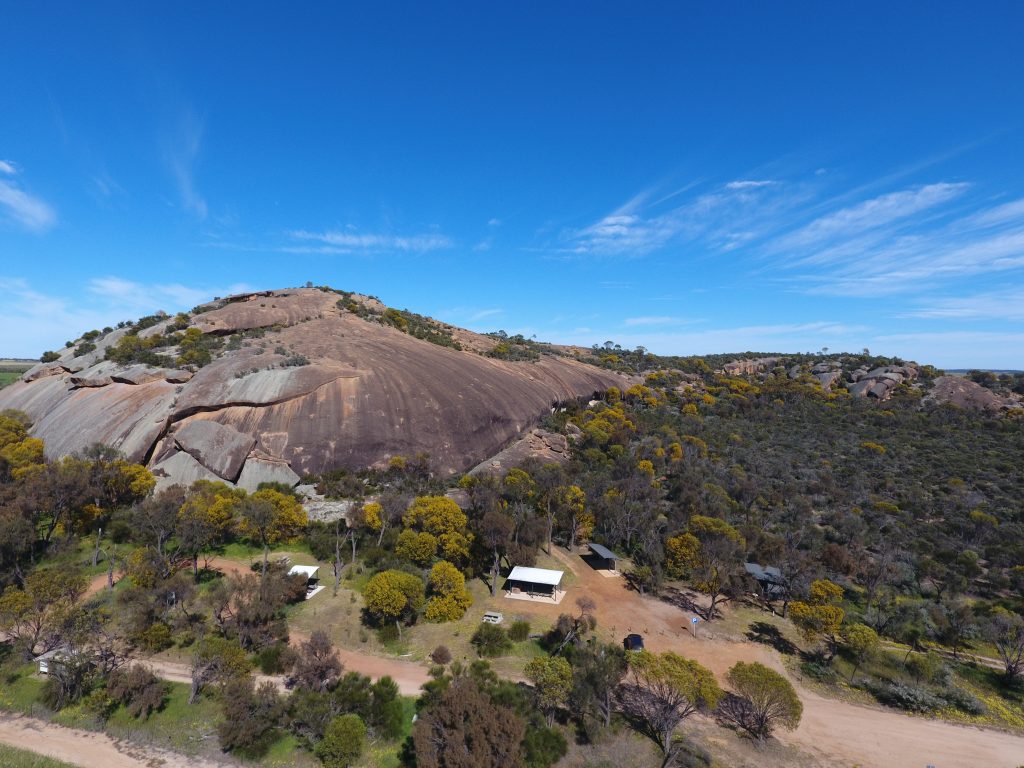
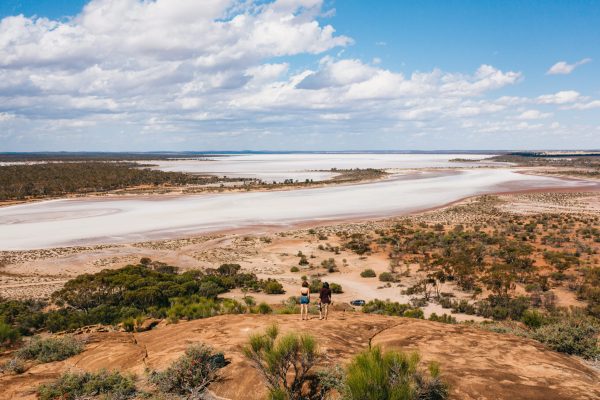
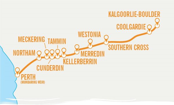
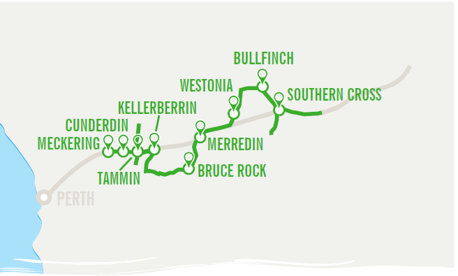
The Eastern Wheatbelt self-drive trail takes visitors on a journey through the towns and surrounding landscape of Cunderdin, Tammin, Kellerberrin, Bruce Rock, Merredin, Westonia and Southern Cross. Here you will find communities rich in heritage, nature reserves abundant in wildflowers and native flora and fauna, soaring granite outcrops and vast salt lakes.

Duration: 3 nights, 4 days
Distance: 770km (one way from Perth)
Road Conditions: sealed roads with stretches of maintained unsealed roads to some attractions

Just 132km, or around 1.5 hours, east of Perth along the Great Eastern Highway lies the town of Meckering, your starting point for the Eastern Wheatbelt self-drive trail. Step into history at the Earthquake Gardens, where powerful displays recall the devastation of the 1968 Meckering Earthquake. View a warped section of the railway line, twisted remains of the Golden Pipeline, and a collection of photographs, statistics, and interpretive signage that bring the event to life.

From Meckering, it’s a short drive to Cunderdin, home to one of the finest rural museums in Western Australia. Housed in the former No. 3 Steam Pumping Station, the Cunderdin Museum, features an extensive collection of pioneer-era artefacts, a Tiger Moth aircraft, the original Quelagetting School building, and an immersive display that recreates the experience of the 1968 earthquake. Right next door, stretch your legs at the CY O’Connor Community Park.

Continue your journey east to Tammin where you’ll discover the Kadjininy Kep Tammin Hydrology Model and Amphitheatre before travelling 26km north of town to Yorkrakine Rock, a solid granite outcrop surrounded by native flora. Follow the walk trail up and over the rock where you’ll find gnamma holes, pockets of vegetation, and sweeping views of the surrounding landscape.

Retrace your steps back toward town and continue on 14kms south to Charles Gardner Reserve. The 600 hectares of natural vegetation contains a wide variety of wildflowers and understorey, some of which are unique to the region.

In Kellerberrin take to the pavement to get a feel for the vibrant history of the town with its excellent examples of 19th and early 20th century architecture. Commencing at the Pioneer Museum on Leake Street with its interesting array of local memorabilia, the trail takes in excellent examples of 19th and early 20th century architecture at the flour mill, post office, St. Joseph’s Catholic Church, Massingham House and the fire station. Don’t miss the view from the Kellerberrin Hill lookout as the pipeline takes you past rock water catchments and springtime wildflowers.

Travelling south of Kellerberrin you will pass some of the most impressive granite rocks in the Wheatbelt – Mouth Caroline and Mount Stirling – before arriving at Australia’s third-largest monolith, Kokerbin Rock. Walk the trails or climb the rock for stunning vistas at the summit.

Nearby at Kwolyin, is a free camp site with toilets, camp kitchen and picnic shelters. The Kwolyin loop trails take visitors through bushland, across Coarin Rock and a walk along the old railway line

Stop in at Shackleton to see Australia’s smallest bank. In Bruce Rock stroll along the Centennial Mosaic Pathway, visit the Bruce Rock Museum and meander through the beautifully landscaped grounds of Remembrance Park.

See a rock wave formation and Charles Hunt’s pioneer well at Totadgin Rock and Conservation Park 14kms south of Merredin. At Merredin Peak, explore the bush walk or rock walk trail to an 1890’s rock wall rainwater catchment around the top of the granite outcrop leading to a rock channel and spillway into Railway Dam.

While in Merredin visit Cummins Theatre, located at 31 Bates Street, which is steeped in local history and hosts high quality performances year-round. Also in town you can explore Merredin’s Railway and Military Museums or take a quick drive 3km west of town to view one of the Public Silo Trail sites.

Cross the original site of the No 1 Rabbit Proof Fence at Burracoppin 20km east of Merredin and head north from Carrabin to Westonia where history is preserved in the towns’ buildings facades. Westonia’s gold mining and social history is encapsulated in the remarkable Hood-Penn Museum with a mine blast simulation tunnel. The Edna May Mine Lookout, located 1km north of town, offers views over a working gold mine.

Visit the Yilgarn history museum in Southern Cross before driving south to Frog Rock Nature Reserve to explore the dam and rock with its wave-like formation.  If time permits travel 55km east to Karalee Rock and Dam one of numerous nature reserves at the start of the world’s largest and healthiest temperate woodland, the Great Western Woodlands.

Accommodation Options
Bed & Breakfasts, self-contained units, farm stays, motels, hotels, caravan parks, RV Friendly towns and free camp sites. For more information visit:
www.wheatbelttourism.com/accommodation